Færsluflokkur: Bloggar
11.7.2011 | 15:37
Day 3. Saunday 10th of July: Hveravellir – Áfangi
 We woke up early at Hveravellir after a difficult night at the loft of a poorly ventilated hut with other tourist (which I apparently kept awake the entire night with my snoring. I am told by others that I snore but I have never heard myself doing that). I needed to do some repairs to my bike before we left which we did at 10:30. The road was much better and the weather was fantastic. Seldom have I traveled Kjol in clear weather like we had today. We decided to have our rendezvous with our transport team at Afangar (which is some 20 km short of finishing the official F35 route which would have been on a smooth road downhill) but this was of necessity since we needed to be at Kidagil in Bardardal NE – Iceland before 23:00. I and Gudjon did however have time to go to the hot tub while we waited for the transport (they went past the meeting point and had to backtrack). We could have biked those 20 km while we waited for them. The statistics for the day. We were moving for 3h and 47m rested for 1h 37m and maintained an averages speed of 10 km/h for theseclose to 40 km that we biked.
 Bloggar | Breytt s.d. kl. 15:42 | Slóð | Facebook | Athugasemdir (1)
10.7.2011 | 23:40
Sunday July 10th - We have finished biking Kjöl
Bloggar | Slóð | Facebook | Athugasemdir (0)
10.7.2011 | 23:33
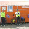
Saturday 9th – a day of difficulties
We started our morning with minor repairs and were on our bikes at 11. The wind was blowing strongly in our face and the road was very bat. We had many difficult hills to climb and the road surface was very rough. Many of the hills were simply not bikable so we had to walk up with our bikes. We made slow progress and the dust was bad when trucks and cars past us. Through the course of the day we however crossed the water divide of Iceland. At one point in time the rivers were flowing to the south and then they were flowing to the north. We also crossed the half way point of this road. To add on to all this were mechanical problems. Gudjons seat came loose and the bracket on the back of my bike (where I hook on the bags) came loose and I lost the screw. I have many loose ones in my had so I was able to replace it but all this took time. I am however very pleased with how will the bikes are standing up to this wear and tear. The statistics for the trip is as follows: We were moving for 6 h and 43 m and stopped for 2h and 15m. Max sped was 27 km/h but the moving average was 6,9 km/h but the overall average was 5,2 km/h. Our max elevation was 704 m.a.s.l. and our total ascent was 753 m which shows how hilly the terrain was that we travelled through. These are the worst roads that I have ever biked.
Bloggar | Slóð | Facebook | Athugasemdir (1)
10.7.2011 | 23:31
Friday July 8th - The first day a good success
Friday July 8th - The first day a good success
We had a later start on the day than planned and departed on our bikes from Gullfoss at 12:20 instead of 9:00 AM as originally intended. The weather was very good clods at the beginning but it cleared up as the day progressed. The wind was against us but it was not strong so it did not play a role. The first 15 km were paved but we were in for a shock when we entered the gravel road or should I say the sand road. For some reason the Road Authorities had used sand to fill the potholes a very futile process since the wind blows it away in a matter of days. There was no way we could cycle in this material. I saw a look of despair in my sons face. Is this what awaits us? Fortunately the part was only 3-4 km after that the road became harder but pretty rough. Then the obstacle of the day – Bláfellsháls. We had to climb 313 meters over this mountain pass but the road was excellent and the weather good. The road was good all the way to Hvítá river but the last 15 km were on rough roads. The statistics for the day are: we biked 43,95 km in 4 hours and 40 minutes which gives the average speed of 9,3 km/h. We rested for 1 hour and 25 minutes and our maximum speed was 33,8 km/h. Greatest elevation was 620 m.a.s.l and our total ascent was 581 m.
Bloggar | Slóð | Facebook | Athugasemdir (0)
8.7.2011 | 01:54
Packed and ready to go!
I have finished packing for the bike trip. Each of us has two 20 litre (at the back) and two 10 litre bags (at the front) in addition to the tents and sleeping bags which we place on the back bracket of the bicycles. I did not way the bags but I do have the feeling that they are a little bit on the heavier side. Once we reach N-Iceland we will have an opportunity to review our loading. Then we will have some sense of what we need and what we do not need. This is however less weight then I had on my trips previously. My only worry is that the bike may break down. We have the usual spear parts (chains, tubes, tires etc.) but we are not equipped for any major breakdowns. The weather forecast is good but the wind will be against us but it will not be a strong one. The nights will also be cold. Once we start biking back (to the south) the winds are forecasted to changes and will therefore be in our face again. Oh well, you can’t win them all!
Bloggar | Slóð | Facebook | Athugasemdir (1)
7.7.2011 | 18:58
Tal - fyrirtæki sem sannar að til sé höfuðlaus her!
Bloggar | Slóð | Facebook | Athugasemdir (1)
7.7.2011 | 18:34
Tal - fyrirtæki með einstaklega lágt þjónustustig
Bloggar | Breytt s.d. kl. 18:36 | Slóð | Facebook | Athugasemdir (0)
6.7.2011 | 11:59
The address of the home page that tracks our progress
Once we start our biking our SPOT satellite transmitter will record our location every 15 minutes you can monitor our progress through the internet by going to the following address:
http://share.findmespot.com/shared/faces/viewspots.jsp?glId=0HIGxSuBiSQ1mjVV9uZjLEqF10SJ0eHqk
There is nothing to be seen there now but I hope that our track will be visible once we start our biking.
Bloggar | Slóð | Facebook | Athugasemdir (0)
6.7.2011 | 01:29
This summer’s bike trip
 I have now put together a final plan for this summer’s bike trip. In the summer of 2009 I biked around Iceland (figure 1) and last summer I biked the Westfjords and Snaefellsnes peninsula (figure 2). During these trips I kept a blog which you can see here below.
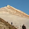
This summer I and my son will bike the interior of Iceland (figure 3). The aim is to go north along mountain route 35 which is called Kjölur (green line on figure 3) and come back south along route 26 which is called Sprengisandur (blue line on figure 3).
 We start the trip on Friday, July 8th. The plan is to bike across Kjölur in 3 days and Sprengisand in 5 days. We will rest one day in Bardadalur NE-Iceland. I will be keeping a daily blog if possible. That depends partly on access to the internet and power.
This summer is the coldest on record here in Iceland for the last 60 years. We still have winter in the interior. In fact Kjölur was only opened to traffic last week and they still have not opened Sprengisandur. I spoke to the road authorities today and they tell me that 13 large and up to 2 m thick snow banks are closing the road. They will attempt to clear the road during the weekend. It will therefor be very cold in our tents as we cross this barren and isolated part of Iceland. The roads will be gravel and rough and in some places the rivers are without bridges.
You will also be able to see our location on the internet since I will be carrying with me a satellite transmitter (SPOT) which logs my passion every 15 minutes. I will post the webpages address for the satellite in the coming days.
 The plan is to bike on averages 40-50 km per day. I am assuming an averages speed on these roads of 8 km per hour. This is probably an underestimate but it is better to allow for more time then less. The plan for the trip is shown below. Last summer I wrote my blog both in English and Icelandic. This is to enable my English speaking friends to keep track of the trip. This is however very time consuming so this year I will only write my blog in English – thus assuming that most Icelanders can read English.
As you can see from the table below we will be biking between 5-10 hours a day, on averages about 6. The longest leg is day 3 (10th of July). That day we will bike 83 km in 10 hours. In all we will cover 452 km. This is much less than last summer when I biked 1100 and in 2009 when I biked 1400 km. This however is all on rough gravel roads so I think this trip might be as hard as the previous ones.
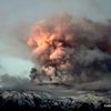
One not of interest – According to the Icelandic radio the volcano Hekla is stirring so we might be biking with a volcanic eruption in the background!
Dagur | Leggur | Vegl km | Leið | Tímar | dagur | Vikud |
1 | Gullfoss-Árbúðir | 43 | F35 | 5,4 | 8 | föst |
2 | Árbúðir - Hveravellir | 45 | F35 | 5,6 | 9 | laug |
3 | Hveravellir - Þjóðvegur 1 Blöndudal | 83 | F35 | 10,4 | 10 | sun |
4 | Flutningur |
|
|
| 11 | mán |
5 | Mýri í Bárðardal -Kiðagilsdrög | 53 | F26 | 6,6 | 12 | þrið |
6 | Kiðagilsdrög - Nýjidalur | 43 | F26 | 5,4 | 13 | mið |
7 | Nýjidalur - Versalir | 56 | F26 | 7,0 | 14 | fimt |
8 | Versalir - Hrauneyjar | 53 | F26 | 6,6 | 15 | föst |
9 | Hrauneyjar-Þjóðvegur 1 | 76 | F26 | 9,5 | 16 | laug |
452 | 56,5 |
Bloggar | Breytt s.d. kl. 11:34 | Slóð | Facebook | Athugasemdir (0)
23.12.2010 | 02:02
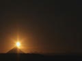
Lunar eclipse in Reykjavík December 21st 2010 – Tunglmyrkvi í Reykjavík 21. desember 2010
I took the fallowing pictures of the lunar eclipse that we had here in Reykjavík on December 21st. At the beginning I exposed the pictures for the bright side. The shadow is black but the bright side is correctly exposed. After the eclipse became full I exposed for the dark part leaving the bright side over exposed.
Ég tók þessar myndir af tunglmyrkvanum 21. desember. Í byrjun myrkvans lýsti ég myndirnar fyrir björtu hliðarnar og er þá skugginn svartur. Eftir að myrkvinn var byrjaður lýsti ég fyrir dökku hliðina og verður þá lýsta hliðin yfirlýst.
Bloggar | Breytt s.d. kl. 02:04 | Slóð | Facebook | Athugasemdir (0)

Nýjustu myndböndin


Heimsóknir
Flettingar
- Í dag (16.9.): 0
- Sl. sólarhring: 1
- Sl. viku: 2
- Frá upphafi: 0
Annað
- Innlit í dag: 0
- Innlit sl. viku: 2
- Gestir í dag: 0
- IP-tölur í dag: 0
Uppfært á 3 mín. fresti.
Skýringar
Bloggvinir
 vulkan
 bjarnihardar
 thjodarsalin
 gbo
gbo
 loftslag
| Sept. 2025 | ||||||
| S | M | Þ | M | F | F | L |
|---|---|---|---|---|---|---|
| 1 | 2 | 3 | 4 | 5 | 6 | |
| 7 | 8 | 9 | 10 | 11 | 12 | 13 |
| 14 | 15 | 16 | 17 | 18 | 19 | 20 |
| 21 | 22 | 23 | 24 | 25 | 26 | 27 |
| 28 | 29 | 30 | ||||