Færsluflokkur: Umhverfismál
10.7.2011 | 23:33
Saturday 9th – a day of difficulties
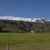
We started our morning with minor repairs and were on our bikes at 11. The wind was blowing strongly in our face and the road was very bat. We had many difficult hills to climb and the road surface was very rough. Many of the hills were simply not bikable so we had to walk up with our bikes. We made slow progress and the dust was bad when trucks and cars past us. Through the course of the day we however crossed the water divide of Iceland. At one point in time the rivers were flowing to the south and then they were flowing to the north. We also crossed the half way point of this road. To add on to all this were mechanical problems. Gudjons seat came loose and the bracket on the back of my bike (where I hook on the bags) came loose and I lost the screw. I have many loose ones in my had so I was able to replace it but all this took time. I am however very pleased with how will the bikes are standing up to this wear and tear. The statistics for the trip is as follows: We were moving for 6 h and 43 m and stopped for 2h and 15m. Max sped was 27 km/h but the moving average was 6,9 km/h but the overall average was 5,2 km/h. Our max elevation was 704 m.a.s.l. and our total ascent was 753 m which shows how hilly the terrain was that we travelled through. These are the worst roads that I have ever biked.
10.7.2011 | 23:31
Friday July 8th - The first day a good success
Friday July 8th - The first day a good success
We had a later start on the day than planned and departed on our bikes from Gullfoss at 12:20 instead of 9:00 AM as originally intended. The weather was very good clods at the beginning but it cleared up as the day progressed. The wind was against us but it was not strong so it did not play a role. The first 15 km were paved but we were in for a shock when we entered the gravel road or should I say the sand road. For some reason the Road Authorities had used sand to fill the potholes a very futile process since the wind blows it away in a matter of days. There was no way we could cycle in this material. I saw a look of despair in my sons face. Is this what awaits us? Fortunately the part was only 3-4 km after that the road became harder but pretty rough. Then the obstacle of the day – Bláfellsháls. We had to climb 313 meters over this mountain pass but the road was excellent and the weather good. The road was good all the way to Hvítá river but the last 15 km were on rough roads. The statistics for the day are: we biked 43,95 km in 4 hours and 40 minutes which gives the average speed of 9,3 km/h. We rested for 1 hour and 25 minutes and our maximum speed was 33,8 km/h. Greatest elevation was 620 m.a.s.l and our total ascent was 581 m.8.7.2011 | 01:54
Packed and ready to go!
I have finished packing for the bike trip. Each of us has two 20 litre (at the back) and two 10 litre bags (at the front) in addition to the tents and sleeping bags which we place on the back bracket of the bicycles. I did not way the bags but I do have the feeling that they are a little bit on the heavier side. Once we reach N-Iceland we will have an opportunity to review our loading. Then we will have some sense of what we need and what we do not need. This is however less weight then I had on my trips previously. My only worry is that the bike may break down. We have the usual spear parts (chains, tubes, tires etc.) but we are not equipped for any major breakdowns. The weather forecast is good but the wind will be against us but it will not be a strong one. The nights will also be cold. Once we start biking back (to the south) the winds are forecasted to changes and will therefore be in our face again. Oh well, you can’t win them all!
6.7.2011 | 01:29
This summer’s bike trip
 I have now put together a final plan for this summer’s bike trip. In the summer of 2009 I biked around Iceland (figure 1) and last summer I biked the Westfjords and Snaefellsnes peninsula (figure 2). During these trips I kept a blog which you can see here below.
This summer I and my son will bike the interior of Iceland (figure 3). The aim is to go north along mountain route 35 which is called Kjölur (green line on figure 3) and come back south along route 26 which is called Sprengisandur (blue line on figure 3).
 We start the trip on Friday, July 8th. The plan is to bike across Kjölur in 3 days and Sprengisand in 5 days. We will rest one day in Bardadalur NE-Iceland. I will be keeping a daily blog if possible. That depends partly on access to the internet and power.
This summer is the coldest on record here in Iceland for the last 60 years. We still have winter in the interior. In fact Kjölur was only opened to traffic last week and they still have not opened Sprengisandur. I spoke to the road authorities today and they tell me that 13 large and up to 2 m thick snow banks are closing the road. They will attempt to clear the road during the weekend. It will therefor be very cold in our tents as we cross this barren and isolated part of Iceland. The roads will be gravel and rough and in some places the rivers are without bridges.
You will also be able to see our location on the internet since I will be carrying with me a satellite transmitter (SPOT) which logs my passion every 15 minutes. I will post the webpages address for the satellite in the coming days.
 The plan is to bike on averages 40-50 km per day. I am assuming an averages speed on these roads of 8 km per hour. This is probably an underestimate but it is better to allow for more time then less. The plan for the trip is shown below. Last summer I wrote my blog both in English and Icelandic. This is to enable my English speaking friends to keep track of the trip. This is however very time consuming so this year I will only write my blog in English – thus assuming that most Icelanders can read English.
As you can see from the table below we will be biking between 5-10 hours a day, on averages about 6. The longest leg is day 3 (10th of July). That day we will bike 83 km in 10 hours. In all we will cover 452 km. This is much less than last summer when I biked 1100 and in 2009 when I biked 1400 km. This however is all on rough gravel roads so I think this trip might be as hard as the previous ones.
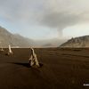
One not of interest – According to the Icelandic radio the volcano Hekla is stirring so we might be biking with a volcanic eruption in the background!
Dagur | Leggur | Vegl km | Leið | Tímar | dagur | Vikud |
1 | Gullfoss-Árbúðir | 43 | F35 | 5,4 | 8 | föst |
2 | Árbúðir - Hveravellir | 45 | F35 | 5,6 | 9 | laug |
3 | Hveravellir - Þjóðvegur 1 Blöndudal | 83 | F35 | 10,4 | 10 | sun |
4 | Flutningur |
|
|
| 11 | mán |
5 | Mýri í Bárðardal -Kiðagilsdrög | 53 | F26 | 6,6 | 12 | þrið |
6 | Kiðagilsdrög - Nýjidalur | 43 | F26 | 5,4 | 13 | mið |
7 | Nýjidalur - Versalir | 56 | F26 | 7,0 | 14 | fimt |
8 | Versalir - Hrauneyjar | 53 | F26 | 6,6 | 15 | föst |
9 | Hrauneyjar-Þjóðvegur 1 | 76 | F26 | 9,5 | 16 | laug |
452 | 56,5 |
 Umhverfismál | Breytt s.d. kl. 11:34 | Slóð | Facebook | Athugasemdir (0)
23.12.2010 | 02:02
Lunar eclipse in Reykjavík December 21st 2010 – Tunglmyrkvi í Reykjavík 21. desember 2010
I took the fallowing pictures of the lunar eclipse that we had here in Reykjavík on December 21st. At the beginning I exposed the pictures for the bright side. The shadow is black but the bright side is correctly exposed. After the eclipse became full I exposed for the dark part leaving the bright side over exposed.
Ég tók þessar myndir af tunglmyrkvanum 21. desember. Í byrjun myrkvans lýsti ég myndirnar fyrir björtu hliðarnar og er þá skugginn svartur. Eftir að myrkvinn var byrjaður lýsti ég fyrir dökku hliðina og verður þá lýsta hliðin yfirlýst.
Umhverfismál | Breytt s.d. kl. 02:04 | Slóð | Facebook | Athugasemdir (0)
22.12.2010 | 14:52
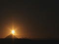
Winter solstices, December 21st 2010 - Vetrarsólstöður 21. desmeber 2010
The following video is based on 1000 photographs that I took on top of Perlan yesterday December 21st this year’s shortest day (Winter solstices). I started at 10AM and continued until 16PM. Unfortunately, the winds were high which causes a slight flicker. In addition the titles for some reason did not come out right.
Meðfylgjandi myndband byggir á 1000 ljósmyndum sem ég tók ofan af Perlunni á vetrarsólstöðum í gær föstudaginn 21. desember. Mikill vindur olli titringi á vélinni sem veldur smá flökti en það er samt fallegt að sjá sólina hnita þennan stutta buga á þessum stysta degi ársins. Ég byrjaði 10 um morguninn eftir að hafa myndað sólmyrkvann og var að til 4 síðdegis. Af einhverjum sökum brenglaðist titillinn.
Umhverfismál | Breytt 23.12.2010 kl. 02:26 | Slóð | Facebook | Athugasemdir (0)
12.7.2010 | 22:28
The last day of biking was a good one – Síðasti dagur ferðar var góður
 The last day of biking was a good one. We woke up early and had the best breakfast of the trip. In fact I want to state that this is the best breakfast I have had in any Icelandic hotel and I have had breakfast in most of them being a guide in the summertime. The wind blew us towards Borgarnes and the sun was out. We did have one very heavy shower just before we entered Borgarnes which left all three of us soaked to the bones. I was hoping that we would do the last 30 km to the tunnel before the weekend traffic would start back to Reykjavík which on a normal Sunday is around 4-5 PM. One big miscalculation was that they were showing the final game of the World Championship in football on TV in the evening and many had taken an early start to be able to catch the game so traffic was very bad but we survived. I took us about 4 hours and 45 min to bike the 84 km we did on this day.
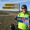
I have calculated the statistic for the whole trip based on my GPS measurements. Of the four that took part I am the only one that biked all the way. In all I biked 1110,4 km in 15 d (two additional days were taken off). I was moving on the bike for 95 hours these 15 days. It is interesting to compare this to last summer when I biked 1400 km in 96 hours! The mountain passes obviously slow you down. My average speed for the trip was 11,7 km/h and the total ascent was 12036 m! For those that do not understand what that means the simple explanation is that the GPS ads to gather all the legs of the trip were we have an increase in elevation. A low value means that you are riding in flat terrain but a big value means that you are going continuously up and down. In short I biked up Hvannadalshnúk, Iceland’s highest mountain (2110 m.a.b.s.l.) six times in these 15 days or Mt,. Everest 1,5 times! Not bad. The statics for each member of the group is below. I will be posting pictures from the trip in some of the coming days. I have included the only picture that I have of all four of us on the bikes. Taken at Rauðsdal.
Name | Distance | Hours | Av. Speed | Total ascent |
Kristinn | 1110,4 km | 95 | 11,7 km/h | 12036 m |
Thelma | 964,4 km | 76,4 | 12,61 km/h | 10736 m |
Lárus | 674,8 km | 62,5 | 10,8 km/h | 8341 m |
MaryAnne | 551,6 km | 43,6 | 12,7 km/h | 6543 m |
Síðasti dagur hjólaferðarinnar var góður. Við vöknuðum snemma og fengum okkur besta morgunmat ferðarinnar að Hóteli Eldborg (Laugagerðisskóli). Ég hef reyndar starfað við leiðsögn undanfarin sumur og hef fengið morgunverð á mörgum hótelum og leifi mér að fullyrða að hvergi er hann jafn vel úti látinn í tegundum og gæðum. Vindurinn bar okkur á vængjum sínum til Borgarness en við fengum að vísu eina blauta góðvirðisskúr rétt áður en við náðum Borgarnesi. Að örðu leiti var veðrið bjart og fagurt. Ég var að vona að við slyppum við helgar umferðina frá Borgarnesi að göngum en gleymdi að reikna með því að úrslitaleikurinn í HM var sýndur síðdegis og margir flýttu því för sinni. Umferðin var þung og erfitt að hjóla þessa síðustu 30 km. Það tók okkur 4 tíma og 45 mín að hjóla þessa 84 km.
Ég er búinn að taka saman tölfræðina fyrir ferðina eins og hún var skráð af GPS tækinu. Útkoman fyrir hvern og einn er sýnd í töflu hér fyrir ofan. Ég er sá eini sem hjólaði alla leið alls 1110,4 km á 95 tímum (15 dögum). Það er athyglisvert að það tók mig 96 tíma (á 16 dögum) að hjóla hringinn 1400 km í fyrra. Svo hægja heiðar og hálsar á manni. Meðalhraði minn var 11,7 km/h en var ef ég man rétt um 16 km/h í fyrra. Það sem er athyglisverðari er að heildarhækkun mín er 12036 m. Fyrir þá sem ekki vita þá þýðir það að tækið leggur saman alla hækkun sem verður á leiðinni. Á flötum vegi er þetta venjulega lág tala en öldóttum há. Ég hjólaði sem sé á þessum 15 dögum 6 sinnum upp á Hvannadalshnúk! eða einum og hálfum sinnum á Evrest! Ég mun setja inn myndir frá ferðinni á næstu dögum. Læt hér fylgja einu myndina sem er til af okkur öllum fjórum á hjóli tekin við Rauðsdal á Barðaströnd.
Umhverfismál | Breytt 13.7.2010 kl. 02:24 | Slóð | Facebook | Athugasemdir (0)
28.6.2010 | 23:29
The wind under my wings – Beggja skauta byr

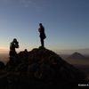
Today was a fantastic day biking. We started at 10:45 from Hólmavik and the first task was to climb up to 440 m.a.s.l. This mountain pass was higher than the one yesterday but the difference was that today we had the wind in the back instead of having it in our faces. We had a tail wind of 11 m/s. Once we had climb up to the highland it was a relatively easy ride to Reykjanes where we arrived at 18:00. After dinner we spent more than an hour in the pool. It was fantastic to bike the first fjord Ísafjord at the end of Isafjardardjup. We biked 90 km in five3 hours and 37 minutes, rested for one hour and 33 mínutes, greatest elevation 451 and total ascent 742. Photo is taken on the top of the mountain pass next to an old sheep herders shelter.
Frábær dagur á hjóli. Fyrsta brekkan var upp á Steingrímsfjarðarheiði en hún var aflíðandi og í stað mótvindar eins og í gær vorum við með 11 m/s í bakið. Áðum við gamla gangnamanna kofann á há heiðinni en síðan tók við fínt rennsli niður af heiðinni og reyndar inn Ísafjörðinn. Vorum á Reykjanesi klukkan 18. Eftir matinn var farið beint í sund. Frábært að hjóla fyrsta fjörðinn. Mikið fuglalíf (sá m.a. smyril ræna kríu unga og mikið af Himbrum). Alls hjóluðum við um 90 km á 5 tímum og 37 mín. Hvíldum okkur í einn tíma og 33 mín. Mesti hraði 43 km/h en meðalhraði 16 km/h. Mesta hæð samkvæmt GPS 451 m en heildarhækkun 743 m. Myndin er tekin við gangnamanna kofann á Steingrímsfjarðarheiði.
Umhverfismál | Breytt s.d. kl. 23:35 | Slóð | Facebook | Athugasemdir (0)
19.5.2010 | 18:27
Hiking up Drangajökull this weekend
 I have been trying to get into form the past weeks for the bike tour this summer. Last week I cycled some 50 km and this Saturday I will hike with my friends up Drangajökull in the Westfjords of Iceland. This is a 30 km hike in all. On the Sunday we intend to hike a mountain called Lambatindur. The forecast is good and those interested can monitor the progress of the hike on the web page given below since I will be carrying a satellite transmitter on the hike. The same one that I will be using on my bike ride this summer.
Ég hef verið á fullu að koma mér í form fyrir hjólatúr sumarsins. Hjólaði m.a. 50 km í síðustu viku og 30 km í þessari. Næstu helgi n.t.t. á laugardaginn ætlum við nokkur að ganga á Drangajökul. Á sunnudaginn er stefnan sett á Lambatind eða Kaldbakshorn á Ströndum (eftir aðstæðum). Spáin er góð. Þeir sem hafa áhuga á að fylgjast með framgangi göngunnar geta gert það á sérstökum vef en ég verð með gervitunglasendi á mérþann sama og ég ætla að nota í sumar í hjólatúrnum. Slóðin á vefsíðuna er gefin hér fyrir neðan
http://share.findmespot.com/shared/faces/viewspots.jsp?glId=0HIGxSuBiSQ1mjVV9uZjLEqF10SJ0eHqk
25.4.2010 | 01:05
New photos

Nýjustu myndböndin


Heimsóknir
Flettingar
- Í dag (18.9.): 0
- Sl. sólarhring:
- Sl. viku: 2
- Frá upphafi: 0
Annað
- Innlit í dag: 0
- Innlit sl. viku: 2
- Gestir í dag: 0
- IP-tölur í dag: 0
Uppfært á 3 mín. fresti.
Skýringar
Bloggvinir
 vulkan
 bjarnihardar
 thjodarsalin
 gbo
gbo
 loftslag
| Sept. 2025 | ||||||
| S | M | Þ | M | F | F | L |
|---|---|---|---|---|---|---|
| 1 | 2 | 3 | 4 | 5 | 6 | |
| 7 | 8 | 9 | 10 | 11 | 12 | 13 |
| 14 | 15 | 16 | 17 | 18 | 19 | 20 |
| 21 | 22 | 23 | 24 | 25 | 26 | 27 |
| 28 | 29 | 30 | ||||